|
Part I
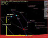
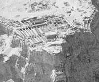
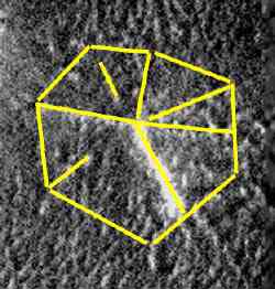
The targeted area was the so-called "City Square" at approximately 40.9 degrees N. by 9.8 degrees W. Inexplicably, after hitting the Face dead on on the previous pass, MGS managed to miss it's target by nearly 2 miles. ("click" on images to enlarge)
What was imaged was
a narrow strip of probably the least interesting portion of
the "City" itself. It contains a few of the less
remarkable polyhedral structures and two of the geometrically
positioned
What was remarkable
was that the navigation team at NASA was able to
place the MGS orbiter almost directly over
the "City" at a very significant time. As the image was
taken, Leo - the stellar depiction of t The idea that an agency capable of such an exquisite expression of an ancient tradition could miss it's mark by nearly 2 miles is laughable.
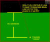
"Downtrack"
is the path back along the spacecraft orbit, represented by the
black arrow.
In other words,
they got exactly what they wanted to get.
MSSS has insisted that the resolution was reduced to correct possible downtrack error and assure hitting the target. But as I have already pointed out, it's the crosstrack that is of concern, and it is so easily accounted for that it presents no major challenge at all. In short, there is no justification for either missing the targeted "City Square" or reducing the image quality. Now why would Malin want - which he obviously must have - to miss the "City Square"? One probable answer lies in the "Giza Scale" mounds placed gracefully about the Cydonia complex
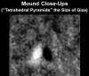
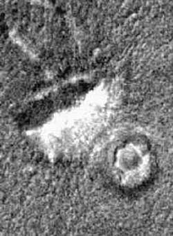
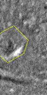
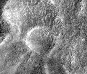
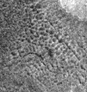
Our first close-up look at mound "P", a corner of a perfectly equidistant triangle, reveals stunning geometry. A perfect hexagon on a raised knoll marks the location, surrounded by a "moat" of sorts. The walls are raised and uniform, and show no signs of the effects of an ocean in the area, which is the supposed explanation for much of what was observed near the Face.
This sort of redundant geometric and "Hyperdimensional" message, observed on the macro scale in the placement of the mounds in tetrahedral configurations and on the microscale in the hexagonal marker adjacent to the mound, is exactly what Carl Sagan was looking for in his treatise's on extraterrestrial life. In other words, from a distance the message is "Artificiality" and "Hyperdimensional Physics". Up close, it's "Artificiality" and "Hyperdimensional Physics".
Recent images and data from the polar regions of the Sun and Saturn confirm that such inwelling points do exist, and imply that the entire Solar system is working on a scale and to a set of rules that we are just beginning to understand.
Now, if this is typical of the mounds in the region, then avoiding imaging an arrangement of 5 similar mounds in the "City Square" would be high on Malin's agenda. It is hard to imagine a stronger confirmation of artificiality if this mound is any example.
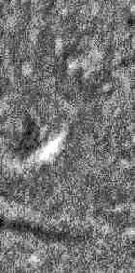
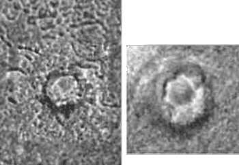
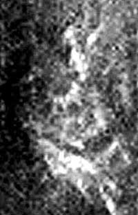
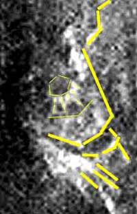
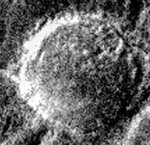
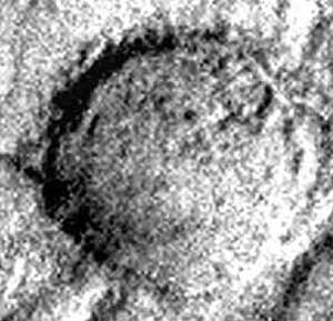
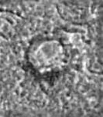
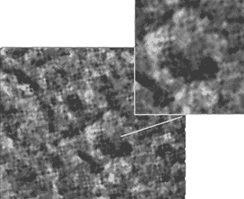
An examination of the second mound "Mound O", is more problematic. The poor lighting and high noise content make this image much more difficult to work with.
However, the same underlying hexagonal layout is visible and noted in the mark-up on the right. Beyond that observation, there isn't much to add.
In the southern portion of the image below the black band is yet another hexagonal structure, somewhat larger but comparably scaled to the other two. Just adjacent to the area Richard Hoagland has referred to as "Leavittown", this hexagon rests on an elevated mound and seems to have intact walls and a central courtyard. The lower wall has indications of tiered horizontal stripping on it.
But what else is there? Surely a massive complex such as the "City", even if it is millions of years old and highly eroded, must posses more than just a few regularly spaced mounds to cite the presence of its magnificent builders upon the Martian sands? It does.
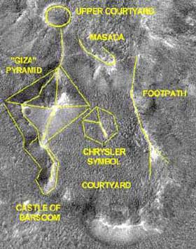
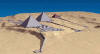
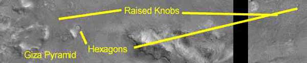
The Pyramid Complex
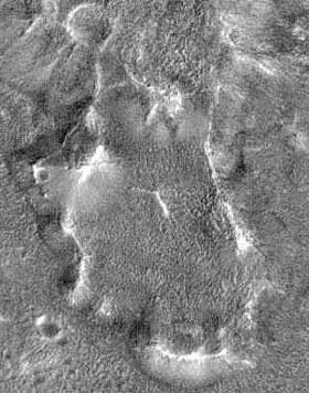
Beyond the incredible pattern of hexagons distributed about the City image, the most striking portion of the area photographed is the southern base of the so-called "West Pyramid" of the City. Vaguely observed in the perspective corrected Viking data, this megalithic adjacent pyramid is at least four times the scale of the Giza monuments. Note the various "courtyards", walled areas and series of obvious walkways connecting the upper sections with the flatlands below.
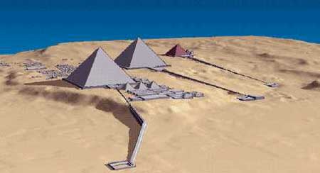
This intricate, highly ordered, multi-tiered complex is an astonishing set of geometric structures with a clear purpose of design. Towering over the nearly enclosed "courtyard" of the west Pyramid is the "Giza" Pyramid, comparable in layout to
the actual Giza complex in Egypt. Both are raised above the local topography and have an obvious walkway leading to an enclosure or structure. In the Egyptian ruins, it is the Sphinx enclosure, at Cydonia, it is the stunning "Castle of Barsoom".
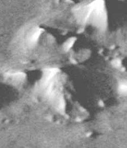
We again see the familiar terraces - here on the microscale - that we saw in the expansive wide angle view of the overall "West Pyramid" system. There are numerous locally vertical supports or struts, and at the top of the structure are six uniform bright segments bracing a hexagonal "cap". Below this are several wider spaced struts, as if the whole set of objects was a gigantic tiered layer cake.
The position of this stacked "Castle" is perfect to serve as a guard tower or citadel at the entrance of the main courtyard.
Masada
Located on the main body of the "West Pyramid" and overlooking the main Courtyard, this walled, eroded geometric structure compares favorably to it's namesake.
Note the blocky, consistent nature of it's walls and their general 90 degree orientation to each other.
The raised outline of the walls corresponds perfectly to crest of the hill it overlooks and are exclusive from any process of natural erosion such as as a hillslide or sandblasting.
The entire area has deep furrows running at right angles to each other and are not aligned with the scan lines of the image.
In short, only modified hills have at walls at the top and right angle geometry inside. [Enhancements 1998 Hoagland]
The Upper Courtyard
The northern side also appears to have experienced a minor collapse. Note also that despite claims that the north side is just a shadow edge, there is a defined intersection between the flat plain and sloped side that is independent of the shallow shadows.
The Chrysler Symbol
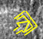
Just below the southeast corner of the Giza Pyramid in the main Courtyard is a remarkable faceted object buried deep in the noise. It seems to be similar in many architectural respects to the D&M Pyramid or even the Corner Pyramid, but the corners are covered by noise and debris. There are several clear, bright vertices and edges which help imply the elevation and define the general outline.
The markup version shows the most obvious facets and the general layout of the object. In scale it is at least twice as big as the Great Pyramid at Giza and it bears a strong resemblance to an eroded pentagonal pyramid. It is possible that the "roof" has been taken off this object, accounting for the blocky regular appearance. The outline at the base is faint but noticeable. Unfortunately, it is doubtful that further enhancements can improve the quality of this image given the low contrast and resolution, so we must hope for a better image on a later orbit to test the accuracy of this shape analysis.
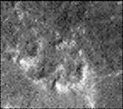
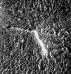
The Suburbs
From "tjp" enhancement of second Cydonia image
Summary
Taken individually, there are perhaps exotic geological explanations which could conceivably account for some or most of what we see at the City. However, the possibility that all of these various (and in some cases, contradictory) process could occur in such a confined area stretches sound reasoning to the break point. The simple reality is that artificial design is the only process which fits the observable data. The additive factor that the Artificiality Hypothesis (AH) inherently and explicitly predicts precisely the sort of formations and geometry's we are now observing leads to the inexorable conclusion - someone built this stuff.
Postscript
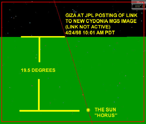
NASA/JPL Continues to Follow Symbolic Pattern in Mars Image Release ("click" on images to enlarge) |

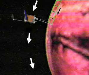 "Crosstrack" is the lateral scanning
normal to the spacecraft along the vertical axis (represented by
the green). Of the two, crosstrack is by far the most difficult
to account for because of uncertainties in the mapping grid
developed by the Rand Corporation.
"Crosstrack" is the lateral scanning
normal to the spacecraft along the vertical axis (represented by
the green). Of the two, crosstrack is by far the most difficult
to account for because of uncertainties in the mapping grid
developed by the Rand Corporation. 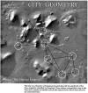