|
from Skywebsite recovered through WayBackMachine Website
Satellite Images of Area Adjacent to Polar Opening
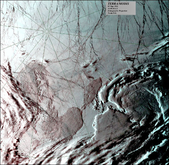
Above is a satellite image from Earth View. This image shows the area on the Siberian side of where the polar opening is suspected of being. Note the bluish, hazy area in the ice cover just above the New Siberian Islands in the center/bottom of the ice cover.
This area is the very area where
polar anomalies were experienced by
the Nansen expedition.
Here we have a closer view - resolution has been lost, of course, due to the magnification.
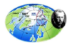
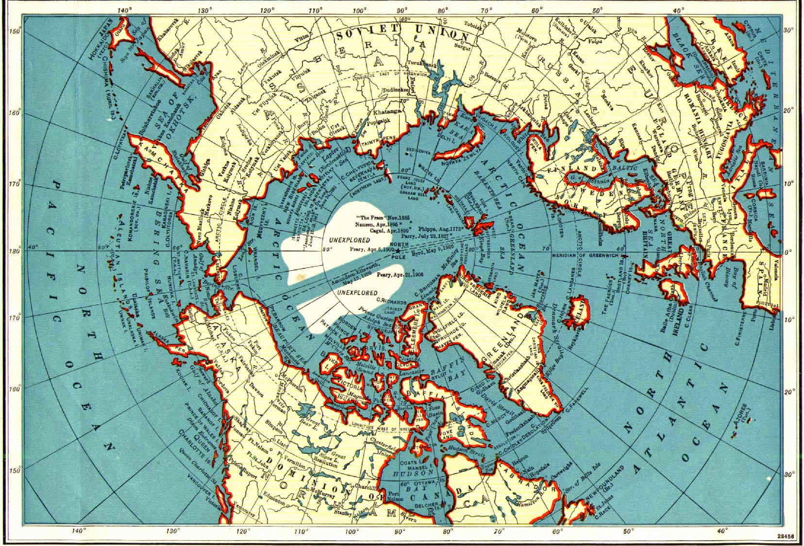
Nansen's Plotted Chart
When
Dr. Fridtjof Nansen explored the
area shown below, in 1895, he and the crew of the ship Fram also
found it free of ice
Dr. Nansen and the crew encountered much
warmer weather than expected from the North, warmer waters the
farther Northwards they went, anomalous open seas, clouds of
volcanic ash which covered the ice and snow from horizon to horizon,
warm-blooded mammals such as- land birds, foxes, and bears- and even
a mirage of the inner sun!
This is the same area of the Arctic Ocean, Northeast of Nova Zemlya,
to which we are referring. It is the very area where Nansen shot
upwards towards the Pole. He and his crew were surprised at the open
water. It was open when Nansen went there is 1895, when Barentz went
there in 1596, and it is still open as evidenced by the Earthview
photos above.
This is not a picture of the opening to the hollow portion of the Earth. It is precisely for this reason that this picture is interesting. As any good Freudian can tell you, it isn't always what a person says that reveals what they are hiding - what a person holds back can expose just as much.
For example, our space agency, NASA (Never A Straight Answer) never makes available such an encompassing, as well as clear, unclouded image of the area in the polar basin where the opening to the hollow world is suspected of being. If this picture were to extend towards the Siberian side of the basin as much as it does towards the Greenland side, then our view might extend down the side of the doughnut-shaped opening and towards the actual neck of the opening.
Maybe this accounts for the unusual
dimensions of the photo: The full photo extends 1033 kilometers from
the pole towards European Russia, 1131 kilometers down towards
Northern Greenland, 390 kilometers towards Canada on the left and
but only 260 kilometers straight up towards the Siberian side, where
the location of the opening is suspected of being, according to the
anomalies observed by Nansen along his route. If only this photo
extended the same distance towards Siberia, with this resolution and
clarity!
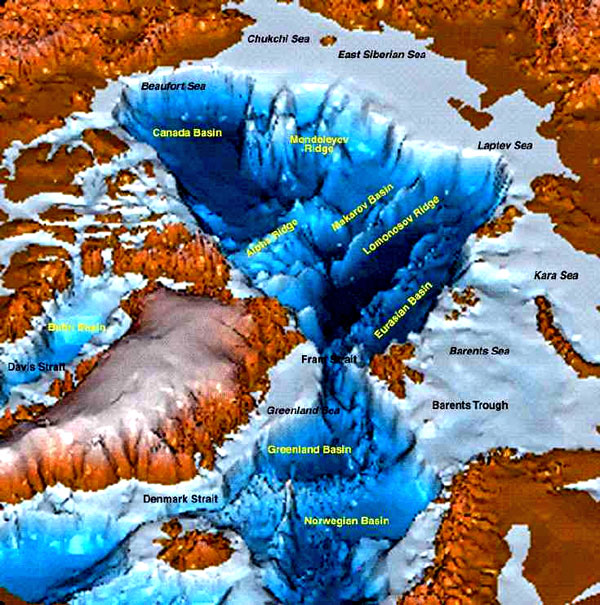
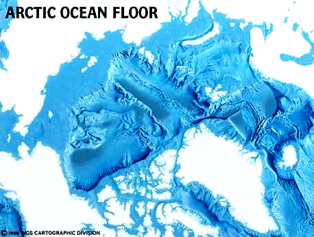
The drawing of the magnetic lines of force, in the second image above, corresponds very well to the deep trench which begins just North of the New Siberian Islands and stretches across the Arctic basin. The floor of this deep trench has not been mapped well, supposedly because of the buildup of so much organic matter on its bottom, i.e., crustacean shells, Mammoth tusks, et cetera, that sonar resonances are weak.
Even so, this is the area where Dr. Fridtjof Nansen had his anomalous Arctic experiences and where the European, North American and Asian tectonic plates come together in a tri corner. For reasons such as these, hollow Earthers will arrive at their own conclusions about what actually exists along this trench in the Arctic basin.
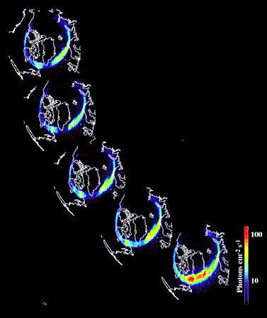
This is a NASA image of a broken auroral
ring. The break is caused by the solar winds which deform the
magnetosphere of the Earth as they " blow " from one side.
The area where the ring is disconnected
corresponds very well to the region indicated above as the region
where the polar opening lies. All told, the break is yet another
indication of the polar opening to the hollow world within.
|


 and
navigable. They left the New Siberian Islands, headed Northwards
across open sea and lodged the ship Fram into the ice at about 79o
North, 138o East latitude. His expedition was exemplary in terms of
polar anomalies experienced by explorers.
and
navigable. They left the New Siberian Islands, headed Northwards
across open sea and lodged the ship Fram into the ice at about 79o
North, 138o East latitude. His expedition was exemplary in terms of
polar anomalies experienced by explorers.